Sargent Maps and History
Way back in 1963 the Army Corp of Engineers decided to cut a channel into the Gulf of Mexico at Sargent. This cut became known as McCabes Cut. As you can see from this 1944 photograph from the Texas Land office there was already an oxbow lake that is just like Old Dead Caney Creek.
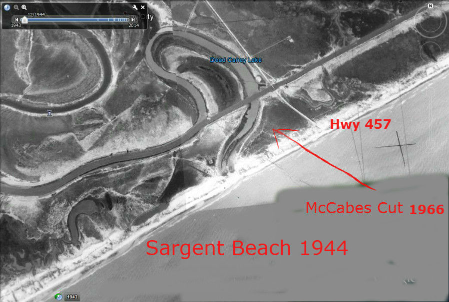
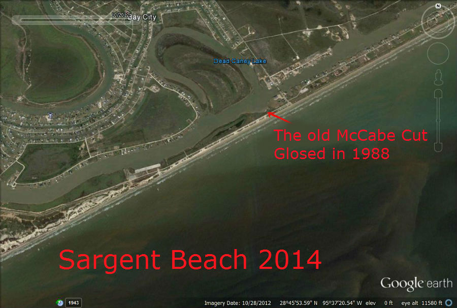
McCabes cut was originaly 40 feet wide and 4 feet deep and over the years grew like a monster. The Cut in 1988 was 300 feet wide and 30 feet deep. By this time Barges and Boats were being sucked out into the Gulf when the tide was right. It was like a giant vacuum cleaner sucking water out to the Gulf and anything that was near it.
So in 1989 a massive plugging of the cut was set about by the Corp. They dammed up the McCabe cut for good. You can still see part of the cut when you drive on Sargent Beach.