


Sargent’s Caney Creek is surrounded by rivers on both West and the East.
Phone numbers for Roads coming in and out of Sargent. Brazoria County 979-864-1064 Matagorda County 979-244-7612
To look at the map from Angleton on the right go left and you cross Brazos River, San Bernard , Caney Creek and the Colorado River.
They run parallel with each other on their journey to the Gulf of Mexico. is the Colorado, San Bernard and the one with the most water volume. The Brazos. The Brazos has been projected to crest at it’s historical 900 year flood crest. Will we have a flood like we did in 1913? 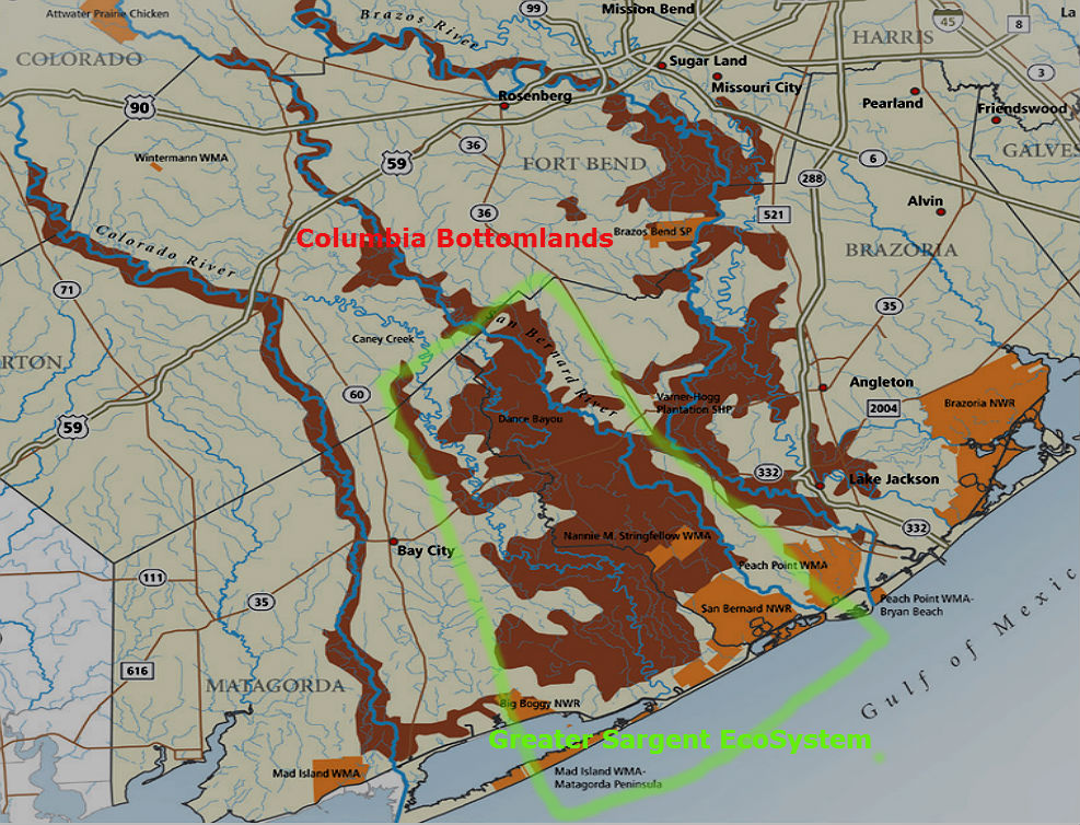
These River are part of and provide the boundaries for the Sargent Ecosystem. This is a rich system of Oak Trees, Prairie which is call the Columbia Bottom lands. This area contains great stands of old growth Oak, White Oak, Cyprus Trees and just to keep on the safe side observe warnings.